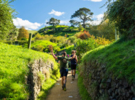
The Antarctica Marathon offers a once-in-a-lifetime experience for adventurous runners.
This extraordinary race takes place on the icy continent, providing a unique and challenging route through stunning, pristine landscapes.
Whether you’re a seasoned marathoner or an adventurous traveller, the Antarctica Marathon promises an unparalleled journey through one of the most remote and beautiful places on Earth.
We’ll break down the Antarctica Marathon route as well as provide a course map to give you a better idea of what to expect.
Overview of the Antarctica Marathon Route
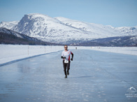
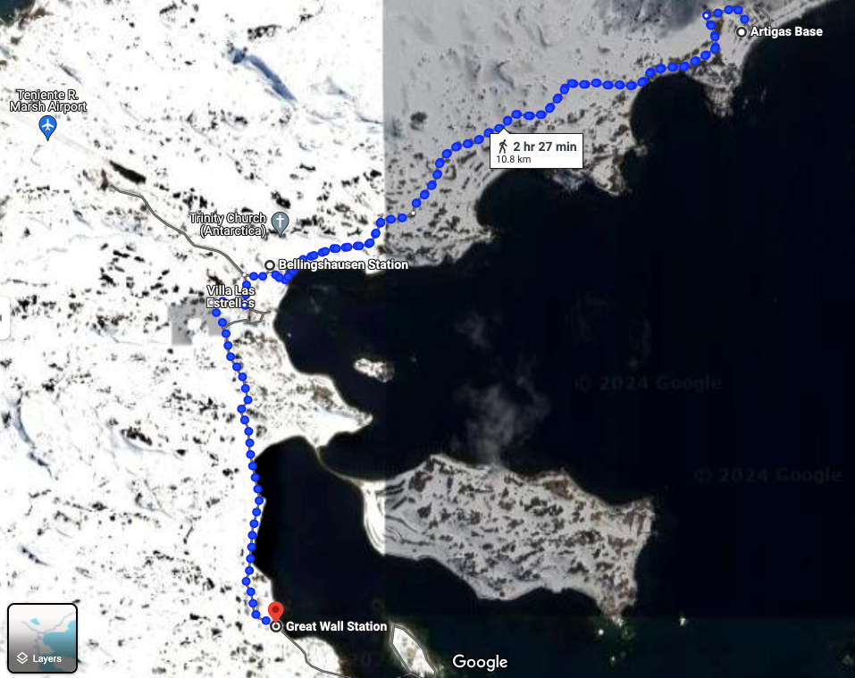
The Antarctica Marathon route is an incredible journey that starts and ends 200 metres (0.12 miles) from the Russian base camp, Bellingshausen Station, on King George Island.
The course is entirely on dirt roads which can often be muddy.
Runners will head through Bellingshausen Station and then head east towards the Uruguayan base, Artigas.
The course has a slight descent for the initial 800 metres (0.5 miles) before a moderate incline for the next 1.4km (0.87 miles).
For the next 2.1km (1.3 miles), until runners reach Artigas, the course is mostly flat
Once at Artigas, they turn back towards Bellingshausen Station, following the same route.
Once participants arrive at Bellingshausen Station, they will head west towards the Chilean base, Villa Las Estrellas.
There is a sharp incline for the next 600 metres (0.37 miles) before runners head south towards the Chinese base camp, Great Wall Station.
There is a consistent, gradual decline for the next 1.1km (0.68 miles) before a steady but gradual incline for the next 1.1km until competitors reach the Great Wall Station.
Once here, they’ll turn around and head back towards Bellingshausen Station via Villa Las Estrellas along the same road they came from.
This completes the loop and marks around 14.2km (8.82 miles) into the race.
Runners do this loop another 2 times (3 total) before heading approximately 200 metres (0.12 miles) towards the finish line where the race began.
There is approximately a 109-metre (358-foot) elevation gain and 98-metre (322-foot) elevation loss each lap of the race.
The total elevation gain is approximately 327 metres (1073 feet) and the total elevation loss is approximately 292 metres (958 feet).
Altitude isn’t a factor in this race with the highest point being approximately 69 metres (226 feet) above sea level however you’ll need to consider a more unique approach to gear and training for the Antarctica Marathon.
Antarctica Marathon Course Map
Below is a screenshot of what the course map would roughly look like.
Looking to take part in this extraordinary event?
If you’re looking to compete in the Antarctica Marathon, you’ll need to book through a registered with an approved travel partner such as Travelling Fit.
Our Antarctica Marathon travel packages not only get you to and from the race but are packed with once-in-a-lifetime adventures and excursions that will create memories that you’ll cherish for the rest of your life.
These include:
- Scenic journeys through the Beagle Channel, Drake Passage, Shetland Islands, and Antarctic Peninsula.
- Guided wildlife excursions and onboard lectures by historians and scientists.
- A half-day guided city tour in Buenos Aires
- Kayaking with whales
- + More
If you’re considering entering this extraordinary event, check out our previous year’s Antarctica Marathon or Half Marathon package pages to learn more and to give you an idea of pricing for the 2025 event. Please use pricing and information on our website as a guide only.
Otherwise, you can always contact us directly if you’d like to speak with a member of our friendly and helpful staff!
Don’t miss out on this unique adventure—register with Travelling Fit today!